 •
EMI-RS series artificial
rainfall
simulator
(GO
TO
TOP) •
EMI-RS series artificial
rainfall
simulator
(GO
TO
TOP)
Application:
Use advanced oscillating
principles to simulate
natural rainfall that
produces water-erosive
momentum, due to the use
of vertical pressure
spray under the
simulated rainfall,
raindrop energy is
larger,It have both
strong wind
capacity(indoor wind
capacity is not
considered),but also
close to natural
rainfall energy(general
field simulation
rainfall winds have a
great impact on the
uniformity of
rainfall,or even
rainfall simulated will
failed.it used to obtain
the different eroded
surface topography,and
obtained some
preliminary laws of the
influence of
slope,underlying surface
and surface soil on
slope erosion and gully
erosion,can obtain
alarge amount of data on
soil erosion and provide
a scientific basis for
soil and water
conservation and
ecllogical construcion.
Measuring Principle:
Artificial simuated
rainfall using
oscillating
principle,the spacing
between the nozzles is
about 1.35 meters,the
height from the ground
is about 2.5 meters,its
specially designed spray
device can controls the
size and intensity of
the raindrops.Rainfall
intensity is determined
by pressure and nozzle
size,the minimum
rainfall intensity is
6.5mm/h,the maximum
rainfall intensity is
200 mm/h.
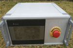
The Main Components Of The
System:
- Aluminum
frame
- Touch screen
operation
control
system
- Adjustable
support
column
- Professional
nozzle
- Dedicated
water
supply
system
- Pressure
adjustment
unit
- Gasoline
Generator(optional)
Features:
- Modular
combination,easy
disassembly
- 7-inch LCD
color
touch
operation,easy
to
adjust
the
instrument
- Two kinds of
rainfall
patterns,one
for the
gear
control,from
small to
large
divided
into 10
files;the
other is
based on
test
needs
can be
arbitrary
stepless
adjustment.
- Rainfall
intensity
range:5mm/h-200
mm/h.
- Rainfall
height 2
- 4.3 m
(optional)
- Operating
temperature:5-50°C
- Motion
control
using
photoelectric
sensors,no
mechanical
wear,arbitrary
working
modes of
the
instrument
satisfy
long-term
work(such
as 724
hours of
uninterrupted
rainfall)
Origin:USA
 •
ROOT-700 Root Growth
Monitoring
System (GO
TO
TOP) •
ROOT-700 Root Growth
Monitoring
System (GO
TO
TOP)
Application:
plant roots play an
important role in fixing
plants and obtaining
moisture and
nutriens,however,the
limit of soil
non-observability brings
some diffculties to the
study of root
ecology.Therefore find
out ways to observe root
growth in situ is
particularly important
for studying root
ecology.Root growth
monitoring system using
the currently most
popular micro-root
window technology in the
world to solve this
problem.Root profile
images can be obtained
by rotating
360°multi-level
rotations in situ in the
soil, the growth
dynamics
of living roots in soil
can be scanned and
monitored.Widely used in
nursery stock
cultivation,crop growth
model research,root
pathology and other
fields.
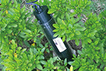
Measuring Principle:
When measuring the
scanner head should
inserted into a clear
rooted probe tube
preembedded in the
soil,the computer will
control the scanning
head to automatically
scan the roots of the
root canal scanning
section of the wall
image.Users can easily
scan root images of
different depths,as well
as images of different
roots,as well as images
of different
roots(different root
cannal).High-resolution
images are obtained with
each scan and the user
can see the detailed
structure of the
rootsystem(or even the
soil particles)
Product Features:
-
Non-destructive
in situ
observation;
-
Non-deformed
linear
scan;High-resolution
images
of 22cm
in
width*20cm
in lengh
are
obtained
for each
scan
-
Very portable
and easy
to
operate
and fast
measurement
-
Can scan
the
roots of
different
levels
of the
image
synthesis
to get
the
overall
root
profileCan
be
fixed,continuous
observation
of the
root
system
of the
dynamic
changes
throughout
-
The growing
season
-
USB data
transmission,measurement,storage
convenience
Technical Specifications:
|
Micro-root
window
image
acquisition
instrument
|
|
Resoluton
|
4800×4800
Pixel
|
|
Software
amplification
resolution
|
19200×19200
Pixel
|
|
Screen
size
|
360°High
resolution
image(22cm×20cm),non-stitched
images
|
|
Scanning
speed
|
5~10
seconds(depends
on
the
scan
resolution)
|
|
Port
|
USB
port
|
|
Data
storage
|
Stored
on
laptop
|
|
Power
supply
|
Powered
by
laptop
USB
port,or
external
battery,or
AC
power
adapter
|
|
Scan
head
size
|
Lengh35.2cm×Diameter7.1cm
|
|
Standard
transparent
tube
size
|
Diameter
7.1cm×Lengh35.2cm(length
can
be
customized)
|
|
Working
environment
|
Temperature0~+50°C,relative
humidity0~100%(non-condensing)
|
|
Weight
|
About
1kg
|
|
Plant
root
image
analysis
software
|
|
Analytical
measurement
|
Root
length;root
average
diameter;root
total
area;root
total
volume;
apical
count;fork
count;overlappded
count;root
diameter
grade
distribution
parameters;you
can
customize
the
segment
diameter
without
spacing,automatically
measure
the
length
of
each
diameter
segment,projection
area,surface
area,volume
and
distribution
parameters.root
tip
length
distribution;can
carry
out
color
analysis
of
the
root
system
to
determine
the
number
of
root
survival,
output
different
color
root
of
diameter,length,projection,area,surface
area
and
volume.root
topology
analysis
can
be
carried
out
automatically
determine
the
number
of
connections,,the
relationship
between
the
angel,etc.,can
be
an
independent
analysis
of
teh
main
root
or
any
one
side
of
the
length
of
the
root
and
the
number
of
bifurcation.can
be
displayed
independently
of
the
root
diameter
of
the
corresponding
segment
of
the
corresponding
parameters(sub-file
number,file
diameter
range
can
be
arbitrarily
changed).bifurcation
of
the
root
can
be
corrected,the
correction
operation
can
be
rolleg
back
to
get
100%
correct
results
quickly.Accuracy:root
length≤±1%,Area:excellent
image
quality<1%,standard
image
quality≤3%.
|
|
Artificial
assistance
correction
|
The
image
can
be
zoomed
out
and
observed
locally,Mouse
area
can
be
selected
to
make
statistics,auxiliary
trim
or
eraser
correction
for
contaminated
area
|
|
Statistical
effects
monitoring
|
Monitor
and
correct
the
accuracy
of
plant
object
analysis.
|
|
Automatic
impurity
removal
|
According
to
the
difference
in
size
and
other
aspects,automatic
impuriy
removal
|
|
Auxiliary
measurement
function
|
with
the
following
magnifying
glass
function,accurate
measurement
by
dragging
the
mouse.
Size
calibration:own
calibration
function,to
achieve
semi-automatic
size
calibration,XY
can
be
calibrated
separately
calibrated
length
measurement:
|
|
Data
report
export
|
Analysis
results
can
be
exported
to
the
excel
table,for
archiving
and
statistics,in
order
to
publish
the
paper.
|
Origin: Germany
 •
TRAC PLUS Plant Canopy
Analyzer (GO
TO
TOP) •
TRAC PLUS Plant Canopy
Analyzer (GO
TO
TOP)
Application:Leaf area
index(LAI) is an
impotant biophysical
parameter in ecology and
climatology,in the field
of ecology and
climatology has a wide
range of
applications.The TRAC
PLUS Plant Canopy
Analyzer uses a unique
and innovative
technology,the
photosynthetically
active radiation
component was measured
along the cross-section
below the canopy,then
convert it into gap
distribution scores,thus
calulating the leaf area
index and other
parameters.
Features:
- High-precision
photosynthetically
active radiation
sensor
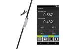
- Test parameter:Leaf
area
index,photosynthetically
active
radiation,Cluster
index,Clearance
rate,
- photosynthetically
active radiation
absorption
components etc.
- One-piece portable
design,easy to
use
- Aluminum
case,durable
- Simple and
convenient
operation,low
cost
- Low-power Bluetooth
wireless data
transmission,the
longest
continuous use
of 120 hours
- No damage
measurement of
leaf area index
and other canopy
parameters
- Android mobile
software,user-friendly
interface
Technical Parameters:
- Measuring wavelength
:400~700nm
- Photosynthetic
active radiation
measurement
range:
0~2500umol/m2/s
- Photosynthetically
Active Radiation
Resolution:
1umol/m2/s
- Photosynthetic
active radiation
accuracy:5%
- Host battery:above
1800mAh
- Dimension:5×30×35mm
- Weight:450g
- Recorder
screen:above 4
inches
- Recorder
battery:above
3500mAh
- Recorder
storage:above
16GB
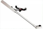
Basic component:
- Light quantum sensor
- Recoder
- Charger
- Host and stand kit
- Built-in lithium
battery
- Software
- Carrying case
Origin: USA
 •
PLS Plus Laser
micro-topogarphy
scanner (GO
TO
TOP) •
PLS Plus Laser
micro-topogarphy
scanner (GO
TO
TOP)
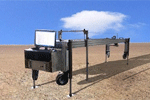
Principle And
Application:Using linear
laser reflection and CCD
imaging principle,the
surface morphology is
converted into
electrical signals at
different object
points,then processed by
computer software into a
digital elevation
model(DEM),then evaluate
the degree of soil
erosion or related
mechanism,compared to
the first generation of
PLS products,scanning
faster and more
accurate,using laptop to
collect data,more
convenient for filed
use.
Parameter:
- Profile
resolution:0.5
mm
- Measuring
length:Standard
3m
- More than 400
sections can be
scanned per
minute
- Laboratory and filed
can both be used
- No soil type
restrictions
- Data is XYZ
elevation or
matrix
The Main System
Component:
- Laptop(optional
field notebook)
- Field use optional
battery or AC
power
supply(Need to
be customized
separately)
Move Frame:
Origin:USA
 •
EP410 Surface Vegetation
Spectrometer (GO
TO
TOP) •
EP410 Surface Vegetation
Spectrometer (GO
TO
TOP)
The EP410 Surface
Vegetation Spectrometer
includes four 16-bit
measurement
channels. During
field measurement,
parameters such as
4-channel measurements
and vegetation index
calculation (such as
NDVI or RVI or PRI and
LAI) can be read
directly on the recorder
display while GPS data
is being
recorded. EP410
surface vegetation
spectrometer optional
sensor is more abundant,
you can use PAR,
infrared / far infrared,
total radiation, light,
UV and other optical
sensors, but also can be
based on user needs,
select custom wavelength
sensor. The
measured data are
exported from the
computer and can be
directly edited and
edited in software such
as Excel and Word.
Application areas:Crops
and gardening,Precision
agricultureclimate
changeSatellite ground
surveyGlobal Carbon
Balance StudyUse
(measurement parameters
to be customized):Can
directly measure or
calculate NDVI, PRI,
MODIS EVI vegetation
index;Calibrate LANDSAT,
MODIS, AHVRR and other
satellite remote sensing
images;Measurement of
total radiation,
photosynthetically
active radiation and
other conventional
parameters, as well as
other band radiation
values.principle:At the
same time, using
different wavelength
optical sensors to
measure the reflection
and radiation spectrum
of the measured object,
the data acquisition
device and the
corresponding processing
software are used to
record the spectral
characteristics of the
measured object.
Technical Parameters:
|
Measurement
channel
|
4
(support
customization)
|
|
Resolution
|
18bit
|
|
Operating
temperature
|
0
~
50
°C
|
|
GPS
accuracy
|
2m
|
|
sensor
type
|
Silicon
solar
cells
|
|
The
sensor
measures
the
wavelength
|
220
~
1100nm
can
be
customized
|
|
Sensor
linearity
error
|
0.2%
|
|
Sensor
absolute
calibration
error
|
Typical
3%,
up
to
5%
|
|
Sensor
response
time
|
10ns
|
|
Material
|
Aluminum
alloy
|
|
powered
by
|
1800mAh
above
rechargeable
lithium
battery
|
|
Battery
life
|
100
hours
|
|
Host
size
|
150mm
*
200mm
*
50mm
|
|
communication
method
|
Bluetooth
low
energy
|
|
Recorder
display
screen
|
4-inch
color
screen
|
|
Recorder
battery
|
3500mAh
rechargeable
lithium
battery
above
|
|
Recorder
storage
capacity
|
16GB
above
|
|
basic
component
|
Handheld
display
data
recorder
and
fixed
bracket
|
|
Sensor
and
bracket
|
User-selected
sensors
with
different
bandwidths
(users
can
customize
them
according
to
their
needs,
the
sensors
comply
with
the
British
National
Standard,
with
calibration
and
response
curves)
|
|
Optional
various
optical
sensors
|
PAR,
IR
/
FAR,
total
radiation,
light,
UVA,
UVB
(all
of
the
above
sensors
are
in
accordance
with
British
National
Standards,
calibration
and
response
curve)
|
Origin:USA
|
|